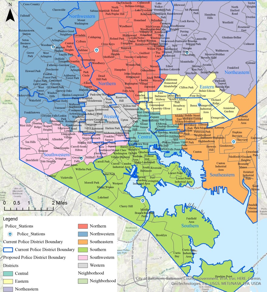
For the first time in 63 years, the Baltimore City Police Department has new police district boundaries. Baltimore City council members approved the new maps in a split vote 12-3 on Monday night.
Council members Eric Costello, Robert Stokes Sr. and Antonio Glover who represent Districts 11, 12 and 13 respectively voted against the measure without comment.
A Maryland state law passed in 2019, required the city to redraw the nine police districts to align with the 2020 U.S. Census population data.
Baltimore City Mayor Brandon Scott said in a statement after the vote, the city’s police department has been patrolling districts with outdated boundary lines.
The new districts reflect “modern population and workload, crime trends and community input,” Scott said. “These districts optimize police response times and will facilitate better engagement between law enforcement and our communities.”
Baltimore City Police Department Commissioner Michael Harrison said during a public hearing about the new districts on Sept. 8 that the new map design is supposed to more equally distribute police work across the city.

For decades, some neighborhoods which have historically worked together to curb crime were in two different districts and now have been united, he said. The map changes were driven by available crime and population data, he said.
“Some people think that I'm talking about easing burdens on police, however, this is so important to our residents, because a balanced workload allows us to optimize and more effectively manage resources and provides proportional policing services in all nine districts,” Harrison said.


